Grange Forest Park History of urban development
|
Originally a project of the GreenBrook
Association -
(now shared with other BushCare groups)
|
Location
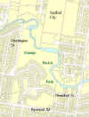
The sketch is
not of good quality but it does show the location of the park.
The first
two photos illustrate the changing land uses over a period of nearly 60
years, while the remainder illustrate how much can be achieved on a
difficult site with constant attention. The latter will have
meaning only if you are familiar with the site. If you are not,
we suggest you try the 2km circuit walk sometime and return to see the
changes that have occurred over the last 20+ years.
(Click on each photo to enlarge).
|

|
1936
Aerial photo
Webster Rd
and Raymond Rd are in place. It shows a skin-drying facility on
the site of the present Stafford Mail Centre. Also the Stafford
Tannery. The land which is Grange Forest Park has been almost
totally cleared of vegetation, the length of the shadows of the
remaining trees indicating that suckering from eucalypt tubers has
begun. So the large gums in Grange Forest Park are 70-80 years
old.
|
copyright
approval to use
not forthcoming,
but this photo is
commercially available |
|
|
Frank Box 07/07/2008
CI 14/10/2011